Killeen weatherWhat’s on in Killeen →
Gatesville

Get out of town

Day trips from Killeen

14 nearby parks, towns and places to explore, ordered by straight-line distance.

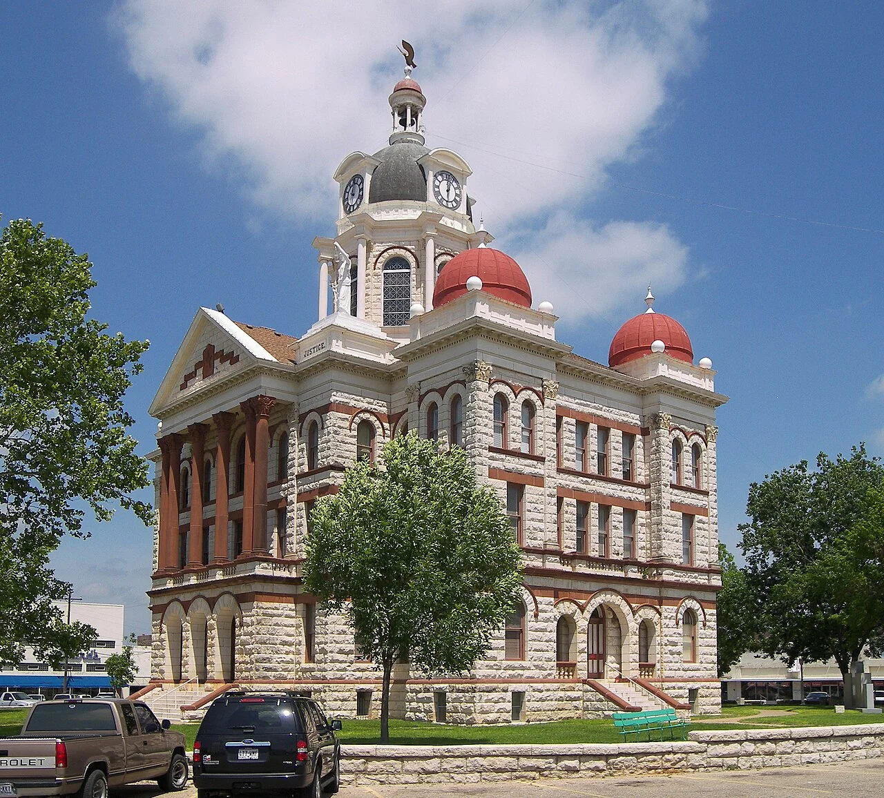
GatesvilleTown

Gatesville

23 miles north · straight-line distanceAbout 40 min by car (38 road miles, typical traffic, checked October 2026)

City in and county seat of Coryell County, Texas, United States.

Confirm the visitor entrance, hours, reservations, access and seasonal conditions. Islands or water destinations may require different transport.
LampasasTown

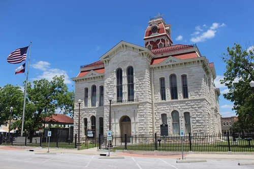
Lampasas

27 miles west · straight-line distanceAbout 30 min by car (31 road miles, typical traffic, checked October 2026)

City in and county seat of Lampasas County, Texas, United States.

Confirm the visitor entrance, hours, reservations, access and seasonal conditions. Islands or water destinations may require different transport.
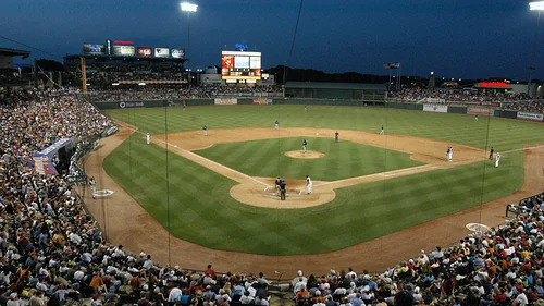
GeorgetownTown

Georgetown

32 miles south · straight-line distanceAbout 40 min by car (39 road miles, typical traffic, checked October 2026)

City in and county seat of Williamson County, Texas, United States.

BoatingCampingFishingHikingPicnickingWater sportsAgency site ↗

Confirm the visitor entrance, hours, reservations, access and seasonal conditions. Islands or water destinations may require different transport.
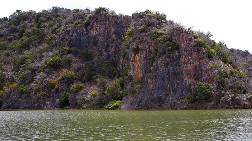
Round RockTown

Round Rock

41 miles south · straight-line distanceAbout 50 min by car (50 road miles, typical traffic, checked October 2026)

City in Travis and Williamson counties in Texas, United States.

Confirm the visitor entrance, hours, reservations, access and seasonal conditions. Islands or water destinations may require different transport.
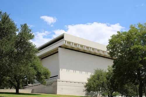
Colorado Bend State ParkState park

Colorado Bend State Park

45 miles west · straight-line distance

State park in Texas, USA.

Confirm the visitor entrance, hours, reservations, access and seasonal conditions. Islands or water destinations may require different transport.
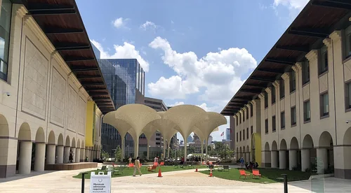
Town

Waco

46 miles northeast · straight-line distanceAbout 1 hr by car (59 road miles, typical traffic, checked October 2026)

City in and the county seat of McLennan County, Texas, United States.

Confirm the visitor entrance, hours, reservations, access and seasonal conditions. Islands or water destinations may require different transport.
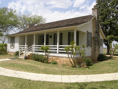
Lyndon Baines Johnson Library and MuseumThings to do

Lyndon Baines Johnson Library and Museum

57 miles south · straight-line distanceAbout 1 hr 5 min by car (66 road miles, typical traffic, checked October 2026)

Presidential library and museum for U.S. President Lyndon B. Johnson in Austin, Texas.

Confirm the visitor entrance, hours, reservations, access and seasonal conditions. Islands or water destinations may require different transport.
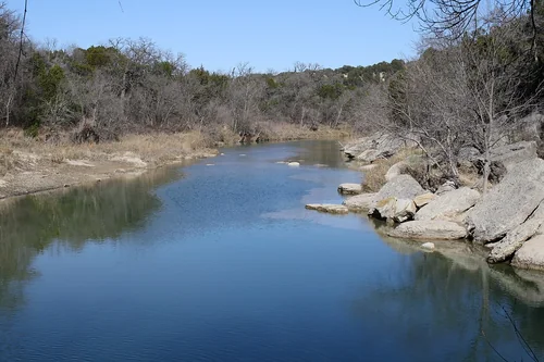
Blanton Museum of ArtThings to do

Blanton Museum of Art

57 miles south · straight-line distanceAbout 1 hr 5 min by car (66 road miles, typical traffic, checked October 2026)

Art museum in Austin, Texas.

Confirm the visitor entrance, hours, reservations, access and seasonal conditions. Islands or water destinations may require different transport.
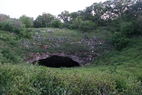
Outdoors

Hamilton Pool Preserve

58 miles southwest · straight-line distanceAbout 1 hr 45 min by car (92 road miles, typical traffic, checked October 2026)

Natural pool of Texas (USA).

Confirm the visitor entrance, hours, reservations, access and seasonal conditions. Islands or water destinations may require different transport.
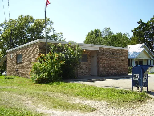
Lyndon B. Johnson National Historical ParkNational park site

Lyndon B. Johnson National Historical Park

71 miles southwest · straight-line distance

Historic district and National Historical Park Gillespie County and Johnson City in Texas, United States.

Confirm the visitor entrance, hours, reservations, access and seasonal conditions. Islands or water destinations may require different transport.

Dinosaur Valley State ParkState park

Dinosaur Valley State Park

79 miles north · straight-line distance

State park of a state of the United States.

Confirm the visitor entrance, hours, reservations, access and seasonal conditions. Islands or water destinations may require different transport.

Bracken CaveOutdoors

Bracken Cave

105 miles south · straight-line distanceAbout 2 hr 30 min by car (140 road miles, typical traffic, checked October 2026)

Texas home to world's largest concentration of bats and mammals.

Confirm the visitor entrance, hours, reservations, access and seasonal conditions. Islands or water destinations may require different transport.

Washington-on-the-BrazosState park

Washington-on-the-Brazos

108 miles southeast · straight-line distance

Ghost town in Washington County, Texas, United States.

Confirm the visitor entrance, hours, reservations, access and seasonal conditions. Islands or water destinations may require different transport.

Things to do

Kimbell Art Museum

116 miles north · straight-line distanceAbout 2 hr 15 min by car (150 road miles, typical traffic, checked October 2026)

Art museum in Fort Worth, Texas.

Confirm the visitor entrance, hours, reservations, access and seasonal conditions. Islands or water destinations may require different transport.

Driving times are typical estimates from the city center without live traffic, Powered by Geoapify · © OpenStreetMap contributors.

Distances are straight-line measurements from the city, not driving distance. Saved road estimates have no consistently recorded source date and are not current traffic; estimates to park centers, water locations or inconsistent routes are omitted. Named-destination route links are not verified entrances. Place descriptions come from Wikidata; photo credits below include recorded capture dates when available. A photograph does not show current conditions.

Outdoor places near Killeen

40 recreation areas and campgrounds within 134 miles, from Recreation.gov. Filter by what you want to do.

Campground

Dana Peak

9 miles southeast · straight-line distanceAbout 20 min by car (11 road miles, checked October 2026)US Army Corps of Engineers

Dana Peak Campground is located on a peninsula on the shoreline of Stillhouse Hollow Lake in central Texas.

BikingCampingFishingHorseback ridingSwimming

Campground

Union Grove

9 miles southeast · straight-line distanceAbout 20 min by car (14 road miles, checked October 2026)US Army Corps of Engineers

Union Grove Park is located on the southwestern shore of Stillhouse Hollow Lake in central Texas.

Camping

Campground

Stillhouse

12 miles southeast · straight-line distanceAbout 20 min by car (14 road miles, checked October 2026)US Army Corps of Engineers

Stillhouse Park is a day use area that has two reservable group pavilions along the shore of Stillhouse Hollow Lake in central Texas.

BoatingCampingFishingSwimming

Recreation area

Stillhouse Hollow Lake

12 miles southeast · straight-line distanceUS Army Corps of Engineers

Historical sites include the Stage Coach Inn in nearby Salado. Stillhouse Hollow Lake is located near the Fort Hood Army Base, which has several points of interest for the military buff.

BoatingCampingFishingHikingPicnickingWater sportsWildlife viewing

Campground

Westcliff

12 miles east · straight-line distanceAbout 25 min by car (16 road miles, checked October 2026)US Army Corps of Engineers

Westcliff Park is a day-use area and campground located on the southwestern shore of Belton Lake.

CampingSwimming

Campground

Belton Lakeview Park

14 miles east · straight-line distanceAbout 25 min by car (17 road miles, checked October 2026)US Army Corps of Engineers

Belton Lakeview Park has two reservable group day-use areas along the lower shore of Belton Lake, providing some of the best fishing and boating in Central Texas.

BoatingCampingFishingPicnicking

Campground

Temples Lake

14 miles east · straight-line distanceAbout 30 min by car (21 road miles, checked October 2026)US Army Corps of Engineers

Temples Lake Park is a day-use facility with over 60 picnic sites and one reservable group area on the southern shore of Belton Lake.

BoatingCampingFishingSwimming

Recreation area

Belton Lake

15 miles east · straight-line distanceUS Army Corps of Engineers

Historical sites include the old "Charter Oak" on the Leon River, near the City of Belton, and the Stage Coach Inn in nearby Salado. Tour Miller Springs Nature Area located below Belton Dam.

BoatingCampingFishingHikingPicnickingWater sportsWildlife viewing

Campground

Live Oak Ridge

15 miles east · straight-line distanceAbout 25 min by car (19 road miles, checked October 2026)US Army Corps of Engineers

Live Oak Ridge campground is located at Belton Lake close by the dam and the city of Belton.

BirdingBoatingCampingCanoeingHiking

Campground

Cedar Ridge (Tx)

17 miles east · straight-line distanceAbout 35 min by car (28 road miles, checked October 2026)US Army Corps of Engineers

Cedar Ridge Park campground is located on the Northern side of Belton Lake. This year-round campground accommodates both tents and RVs and has several sites with screened shelters for those who do not have camping equipment.

BirdingBoatingCampingFishingHikingPicnickingSwimmingWater Activities

Campground

White Flint Park

17 miles northeast · straight-line distanceAbout 40 min by car (32 road miles, checked October 2026)US Army Corps of Engineers

White Flint Park is located at Belton Lake, which provides some of the best fishing, camping and boating in Central Texas.

BirdingBoatingCampingCanoeingFishingKayakingPaddlingWater Access

Campground

Winkler Park

18 miles northeast · straight-line distanceAbout 40 min by car (34 road miles, checked October 2026)US Army Corps of Engineers

Winkler Park is a small, primitive campground on the northern shore of Belton Lake in Central Texas.

BikingBirdingBoatingCampingCanoeingFishingHikingKayaking

Campground

Jim Hogg Park

29 miles south · straight-line distanceAbout 45 min by car (37 road miles, checked October 2026)US Army Corps of Engineers

Jim Hogg Park sits on the north side of Georgetown Lake in the Hill Country of Texas, about 25 miles north of Austin. Recreation Boating is the most popular way to enjoy the lake, and a boat ramp is provided for guests.

BirdingBoatingCampingFishingHikingHuntingMountain BikingPaddling

Campground

Tejas Park

29 miles south · straight-line distanceAbout 45 min by car (37 road miles, checked October 2026)US Army Corps of Engineers

Tejas Park sits on the south side of Georgetown Lake in the Hill Country of Texas, about 25 miles north of Austin.

CampingFishingHikingHuntingMountain BikingPaddlingWater ActivitiesWildlife viewing

Campground

Cedar Breaks Park

30 miles south · straight-line distanceAbout 45 min by car (40 road miles, checked October 2026)US Army Corps of Engineers

Cedar Breaks Park sits on the south side of Georgetown Lake in the Hill Country of Texas, about 25 miles north of Austin. Recreation Boating is the most popular way to enjoy the lake, and a boat ramp is provided for guests.

BoatingCampingFishingHikingHuntingMountain BikingPaddlingPicnicking

Recreation area

Georgetown Lake

30 miles south · straight-line distanceUS Army Corps of Engineers

Located 4 mi W of Georgetown via FM 2338, the lake is easily accessible from the Austin area. The dam impounds the San Gabriel River in the Hill Country of central Texas.

BoatingCampingFishingHikingPicnickingWater sportsWildlife viewing

Campground

Russell Park

30 miles south · straight-line distanceAbout 45 min by car (38 road miles, checked October 2026)US Army Corps of Engineers

Russell Park is located on the west side of Georgetown Lake, in the Texas Hill Country approximately 25 miles north of Austin. Visitors enjoy boating, fishing and exploring the San Gabriel River Trail.

BoatingCampingFishingHikingHuntingMountain BikingPaddlingPicnicking

Campground

Willis Creek

34 miles southeast · straight-line distanceAbout 55 min by car (49 road miles, checked October 2026)US Army Corps of Engineers

Willis Creek is the ideal place for campers looking for a variety of accommodations. A group campground and five equestrian sites are available, in addition to a row of standard camping sites.

CampingFishingHorseback ridingSwimmingWater sports

Campground

Friendship Park

35 miles southeast · straight-line distanceAbout 1 hr by car (52 road miles, checked October 2026)US Army Corps of Engineers

Friendship Park is located in the gently rolling hills of the Texas Blackland Prairie. In the Spring it offers and exceptional array of wildflowers that blanket the landscape.

CampingWildlife viewing

Recreation area

Granger Lake

37 miles southeast · straight-line distanceUS Army Corps of Engineers

Open to the public March 1981, know as one of the top five crappie/white bass fishing spots in Central Texas.

BoatingCampingFishingHorseback ridingPicnickingWater sportsWildlife viewing

Campground

Taylor

37 miles southeast · straight-line distanceAbout 1 hr by car (57 road miles, checked October 2026)US Army Corps of Engineers

Taylor Campground, on the banks of Granger Lake, is an excellent lakeside destination for families of all ages. The park pleases nature lovers with its hiking trail and water skiers with its easily accessible boat dock.

BikingCampingFishingHikingSwimmingWater sportsWildlife viewing

Campground

Wilson H Fox

37 miles southeast · straight-line distanceAbout 1 hr by car (59 road miles, checked October 2026)US Army Corps of Engineers

Wilson H. Fox Park attracts a variety of campers looking for a fun-filled escape. In springtime, the campground is a colorful place covered in a blanket of wildflowers.

CampingSwimming

Campground

Midway

41 miles northeast · straight-line distanceAbout 55 min by car (60 road miles, checked October 2026)US Army Corps of Engineers

Midway Park is ideal for families and friends to enjoy sightseeing and water activities, all while staying within the Waco city limits.

BoatingCampingFishingSwimming

Campground

Twin Bridges Group Shelter

41 miles northeast · straight-line distanceAbout 1 hr by car (61 road miles, checked October 2026)US Army Corps of Engineers

Twin Bridges, located on one of Waco Lake's sandy beaches, is ideal for families and friends to enjoy picnicking, sightseeing and water activities, all while staying within the Waco city limits.

BoatingCampingFishingSwimmingWater Access

Campground

Speegleville Park

42 miles northeast · straight-line distanceAbout 1 hr 5 min by car (63 road miles, checked October 2026)US Army Corps of Engineers

Speegleville Park is perched on the south end of a scenic cove of Waco Lake. The park provides outdoor recreation options like boating, jet skiing, fishing, swimming and bird watching.

BoatingCampingFishing

Recreation area

Balcones Canyonlands National Wildlife Refuge

45 miles southwest · straight-line distanceFish and Wildlife Service

This rugged terrain has spared old Ashe juniper and oak woodlands from logging and shelters some of the best golden-cheeked warbler habitat. The Brazos tributaries to the north cut only shallow canyons.

BirdingHikingHuntingPhotographyRanger programsWildlife viewing

Recreation area

Waco Lake

45 miles northeast · straight-line distanceUS Army Corps of Engineers

The largest lake in the United States to be located entirely within a single city's municiple boundaries.

BoatingCampingFishingHikingHotel/Lodge/Resort Privately OwnedNature educationPicnickingWater sports

Recreation area

Whitney Lake

56 miles north · straight-line distanceUS Army Corps of Engineers

There are 10 Corps of Engineers parks, one state park, and three additional parks managed by Hill County or private individuals. Equestrian riders have a great place to explore rolling hills and woods in the McCown Valley Equestrian Area.

BikingBoatingCampingFishingHikingHorseback ridingHotel/Lodge/Resort Privately OwnedPicnicking

Recreation area

Aquilla Lake

64 miles northeast · straight-line distanceUS Army Corps of Engineers

This 3,280-acre lake is located on Aquilla and Hackberry Creeks.

BoatingFishingPicnickingWater sportsWildlife viewing

Recreation area

Proctor Lake

75 miles northwest · straight-line distanceUS Army Corps of Engineers

Located in historic territory of the Comanche Indians, Proctor Lake offers a wide variety of activities both on and off the water.

BoatingCampingFishingPicnickingWater sportsWildlife viewing

Recreation area

Navarro Mills Lake

84 miles northeast · straight-line distanceUS Army Corps of Engineers

Navarro Mills Lake holds the state record white crappie at 4lbs 9 ounces.

BoatingCampingFishingHikingKayakingPicnickingSwimmingWater sports

Recreation area

Somerville Lake

89 miles southeast · straight-line distanceUS Army Corps of Engineers

Nearby points of interest include Bluebonnet Trails, Independence Day Trek and Salt Grass Trek.

BikingBoatingCampingFishingHikingHorseback ridingHotel/Lodge/Resort Privately OwnedPicnicking

Recreation area

Canyon Lake

90 miles south · straight-line distanceUS Army Corps of Engineers

In the early part of the 19th century, the lower Guadalupe River Basin, below the current location of Canyon Lake, had been especially subject to serious flooding. Congress authorized in the 1940's the construction of Canyon Lake Dam.

BoatingCampingFishingHikingHorseback ridingHotel/Lodge/Resort Privately OwnedNature educationPicnicking

Recreation area

Bardwell Lake

103 miles northeast · straight-line distanceUS Army Corps of Engineers

Bardwell Lake is located in the Blackland Prairie region of southwestern Ellis County. Built in 1965 for flood control by the US Army Corps of Engineers, Bardwell Lake is located two miles southwest of Ennis off of State Highway 34.

BoatingCampingFishingHikingPicnickingWater sportsWildlife viewing

Recreation area

Benbrook Lake

108 miles north · straight-line distanceUS Army Corps of Engineers

Benbrook Lake is located in the scenic open countryside of rolling hills and prairie meadows southwest of Fort Worth, Texas.

BoatingCampingFishingPicnickingWater sportsWildlife viewing

Recreation area

Joe Pool Lake

114 miles northeast · straight-line distanceUS Army Corps of Engineers

Joe Pool Lake is a 7,400-acre impoundment located in the southern portion of the Dallas-Fort Worth Metroplex.

BikingBoatingCampingFishingHikingHistoryHorseback ridingHotel/Lodge/Resort Privately Owned

Recreation area

Hords Creek Lake

120 miles northwest · straight-line distanceUS Army Corps of Engineers

Located approximately 8 miles west of Coleman, Hords Creek Lake is one of Texas' most pretty little lakes. The lake is surrounded by beautiful oak trees and offers many activities to all those who enjoy the outdoors.

BoatingCampingFishingPicnickingWater sportsWildlife viewing

Recreation area

San Antonio Missions National Historical Park

131 miles south · straight-line distanceNational Park Service

to San Antonio Missions, a National Park Service site and the only UNESCO World Heritage Site in Texas. Each mission in the park is a center of community and has been since the early 1700s.

Biking

Recreation area

Attwater Prairie Chicken National Wildlife Refuge

132 miles southeast · straight-line distanceFish and Wildlife Service

Attwater Prairie Chicken National Wildlife Refuge was established in 1972 to provide habitat for one of the last populations of the critically endangered Attwater’s Prairie-Chicken , a ground-dwelling grouse of the coastal prairie…

BikingBirdingHikingPhotographyPicnickingRanger programsWildlife viewing

Recreation area

Grapevine Lake

134 miles north · straight-line distanceUS Army Corps of Engineers

Centrally located in the heart of the Dallas/Fort Worth Metroplex just minutes from DFW Airport, Grapevine Lake offers a variety of outdoor recreation opportunities.

BikingBoatingCampingFishingHikingHorseback ridingHotel/Lodge/Resort Privately OwnedNature education

Recreation areas and campgrounds from Recreation.gov's directory, checked October 9, 2026. Listings are not live availability: check Recreation.gov or the managing agency for open dates, fees, reservations and conditions. Directions go to the listed coordinates, which may not be the entrance. Campground driving times: Powered by Geoapify · © OpenStreetMap contributors.

Questions

What day-trip ideas are near Killeen?

This guide includes Gatesville, Lampasas, Georgetown, Round Rock, Colorado Bend State Park. Places are ordered by straight-line distance. Confirm visitor access, opening hours and current travel conditions before choosing a trip.

How far is Gatesville from Killeen?

Approximately 23 miles north in a straight line; driving takes about 40 min over 38 road miles in typical traffic (Geoapify, checked October 2026). This is not current traffic or a route to a verified visitor entrance. Use the named destination and confirm the appropriate entrance or transport.

How far is Lampasas from Killeen?

Approximately 27 miles west in a straight line; driving takes about 30 min over 31 road miles in typical traffic (Geoapify, checked October 2026). This is not current traffic or a route to a verified visitor entrance. Use the named destination and confirm the appropriate entrance or transport.

How far is Georgetown from Killeen?

Approximately 32 miles south in a straight line; driving takes about 40 min over 39 road miles in typical traffic (Geoapify, checked October 2026). This is not current traffic or a route to a verified visitor entrance. Use the named destination and confirm the appropriate entrance or transport.

Where can I camp near Killeen?

Recreation.gov lists 21 campgrounds within 42 miles, including Dana Peak (9 miles southeast), Union Grove (9 miles southeast), Stillhouse (12 miles southeast). Check Recreation.gov for current availability, seasons and reservations.

Killeen AI

Your Killeen local guide
Hey there!

I'm Killeen AI. Ask about neighborhood food, independent shops, local history or planning a visit.

AI recommendations may be inaccurate. Verify hours and prices. Questions are processed by Cloudflare. Privacy